Not sure why there are two .map files with the same name
MAPS: Post information about new maps here please
Moderator: Wonderdoctor
-
Wonderdoctor

- Generalstabsveterinär

- Posts: 444
- Joined: 2019-09-20 19:46, Friday
- Location: Amsterdam, Dietsland
Re: MAPS: Post information about new maps here please
The second one looks a lot better. The .map file have was downloaded in 2017 and is the first one.
Not sure why there are two .map files with the same name
Not sure why there are two .map files with the same name


Re: MAPS: Post information about new maps here please
It seems no one has the original arras.map file....
So I took the April 2000 file found on the CD and corrected --> the road going 7 hex in the river and some other small bugs
Who wants can download
https://drive.google.com/file/d/14DoesA ... sp=sharing
and MAP128txt
https://drive.google.com/file/d/14Lb4qU ... sp=sharing


Re: MAPS: Post information about new maps here please
Generally errors in the mapx file are not too bad since everything can be corrected in the scenario file when building a scenario. There are many mapx files with smaller or bigger errors. Also in some of my mapx files are errors. It happens 

Slava Ukraini! 
Re: MAPS: Post information about new maps here please
Of course you're right --> you'll also find errors in my *.mapx files
Now the scenario contains terrain and names and army locations and roads and railways.. and it doesn't need a mapx file to play the scenario
In the days of PG2 - without a map file - it was not possible to recreate a scenario. It contained information about the terrains needed for the game
I do not believe that one of the first maps - had such large discrepancies between the drawing and the *.map file
For example -There are roads and a highway in the picture
Why draw - if you don't mark several hexes as a road later? After all, this is France and summer, not Russia and winter ...
The river does not flow where it is drawn - only in a different place?
Compare map 449 - it's exactly the same drawing
Why assign a new number - only the *.map file has changed?
Because you couldn't make a new scenario with a different terrain on map 128
A new map was needed for that
That's why I asked for the original file...
Re: MAPS: Post information about new maps here please
Hello  A new map is finished:
Number: 1573
Name: Pemba (3K)
Location: Tanzania
Period: WWII
Map size: 3150;3000
Comment: mod of map 1445
Number: 1573
Name: Pemba (3K)
Location: Tanzania
Period: WWII
Map size: 3150;3000
Comment: mod of map 1445
Slava Ukraini!
-
LuisGuzman

- General, Special Forces

- Posts: 824
- Joined: 2019-03-10 08:35, Sunday
- Location: Spain
- Contact:
Re: MAPS: Post information about new maps here please
Uploaded to MapFinder and OG's map repo.
Visit my website to get my latest tools.
Re: MAPS: Post information about new maps here please
Hello Another map is finished:
Number: 1569
Name: Terceira
Location: Portugal
Period: WWII
Map size: 3150;3000
Number: 1569
Name: Terceira
Location: Portugal
Period: WWII
Map size: 3150;3000
Slava Ukraini!
-
LuisGuzman
- General, Special Forces
- Posts: 824
- Joined: 2019-03-10 08:35, Sunday
- Location: Spain
- Contact:
Re: MAPS: Post information about new maps here please
Done, available at Mapfinder and OG's map repo
But check it in MapFinder please, as it took too long to upload both the png and the jpg
Visit my website to get my latest tools.
Re: MAPS: Post information about new maps here please
Thank youLuisGuzman wrote: ↑2023-01-25 20:03, Wednesday Done, available at Mapfinder and OG's map repo
But check it in MapFinder please, as it took too long to upload both the png and the jpg
I can open in browser and download the map from mapfinder without problem
Only the preview on the start site is too small. But after 3 months the preview will be gone anyway.
Slava Ukraini!
Re: MAPS: Post information about new maps here please
Hi Luis
The file 1569.jpg has more weight than 1569.png ...
It's set to --> JPEG, quality: 85, subsampling ON (2x2), and it should
JPEG, quality: 70, subsampling ON (2x2)
I don't know if it matters ...
The file 1569.jpg has more weight than 1569.png ...
It's set to --> JPEG, quality: 85, subsampling ON (2x2), and it should
JPEG, quality: 70, subsampling ON (2x2)
I don't know if it matters ...
Re: MAPS: Post information about new maps here please
That is correct. When i created the files with photoshop, the jpg also had a bigger file size.
Slava Ukraini!
Re: MAPS: Post information about new maps here please
Randowe, I agree with you 
It was information for Luis
Remember when we talked about maps and Luis wrote
It was information for Luis
Remember when we talked about maps and Luis wrote
Only thatFor automatic download, I upload the .jpg file received from mapmaker if available, otherwise I convert the .png file using IrfanView with a 70% compression ratio.
Re: MAPS: Post information about new maps here please
The compression rate is a little bit misleading anyway. I save the jpg with 50% quality in photoshop. I found that it is a good compromise between file size and quality. So with every handling / compression of the file later, the quality can not get batter than the initial 50% anyway.sympatyk wrote: ↑2023-01-26 15:08, Thursday Randowe, I agree with you
It was information for Luis
Remember when we talked about maps and Luis wrote
Only thatFor automatic download, I upload the .jpg file received from mapmaker if available, otherwise I convert the .png file using IrfanView with a 70% compression ratio.
Slava Ukraini!
Re: MAPS: Post information about new maps here please
I understand exactly, but neither Photoshop nor Gimp nor any other program is a reference
Luis uses programs that reduce the weight of the file by removing the information contained in the image file
If you provide a png file --> automatic cleans and converts the file to jpg - by a factor of 70% --> this is how it was assumed
Why am I interested?
The mirror download server is at Kowdar's
I take care of the maps and complete them (on the server)
I only have permission to add maps --> I'm interested in the final version --> that's why I want this information to reach Luis
Here is the converted version with a 70% ratio (png --> jpg) view and compare both jpg versions
https://drive.google.com/file/d/14V78dB ... sp=sharing
Re: MAPS: Post information about new maps here please
Hello A new map is finished. I'll submit the jpg file only because the png has more than 6mb. If somebody needs the png for map making, please let me know.
Number: 1583
Name: Harpers Ferry (3K)
Location: USA
Period: WWII
Map size: 3150;3000
Comment: mod of maps 1420; 1487
Number: 1583
Name: Harpers Ferry (3K)
Location: USA
Period: WWII
Map size: 3150;3000
Comment: mod of maps 1420; 1487
Slava Ukraini!
-
LuisGuzman
- General, Special Forces
- Posts: 824
- Joined: 2019-03-10 08:35, Sunday
- Location: Spain
- Contact:
Re: MAPS: Post information about new maps here please
Done!randowe wrote: ↑2023-02-18 20:07, Saturday Hello
Number: 1583
Name: Harpers Ferry (3K)
Location: USA
Period: WWII
Map size: 3150;3000
Comment: mod of maps 1420; 1487
Available at MapFinder and OG's repo
Visit my website to get my latest tools.
Re: MAPS: Post information about new maps here please
Number: 1584
Name: Liepaja (3K)
Location: Latvia
Period: WWII
Map size: 3150;3000
Comment: mod of map 1468
Slava Ukraini!
-
LuisGuzman
- General, Special Forces
- Posts: 824
- Joined: 2019-03-10 08:35, Sunday
- Location: Spain
- Contact:
Re: MAPS: Post information about new maps here please
Uploaded to MapFinder and OG's repo
Visit my website to get my latest tools.

Re: MAPS: Post information about new maps here please
New map is finished
Number: 50029
Name: Siauliai (3K)
Location: Lithuania
Period: WWII
Map size: 3300;3300
Comment: the map represents the area from East Prussia to Liepaja (Libava). Due to historic period all names in East Prussia area are given as their original German ones - Tilsit instead of Sovetsk, Insterburg instead of Chernyakhovsk etc.
-
LuisGuzman
- General, Special Forces
- Posts: 824
- Joined: 2019-03-10 08:35, Sunday
- Location: Spain
- Contact:
Re: MAPS: Post information about new maps here please
Done! - the map is available from OG's repoMaXX_Oltt wrote: ↑2023-03-09 11:33, Thursday
New map is finished
Number: 50029
Name: Siauliai (3K)
Location: Lithuania
Period: WWII
Map size: 3300;3300
Comment: the map represents the area from East Prussia to Liepaja (Libava). Due to historic period all names in East Prussia area are given as their original German ones - Tilsit instead of Sovetsk, Insterburg instead of Chernyakhovsk etc.
Visit my website to get my latest tools.
Re: MAPS: Post information about new maps here please
How can I download mapX for this map?
-
LuisGuzman
- General, Special Forces
- Posts: 824
- Joined: 2019-03-10 08:35, Sunday
- Location: Spain
- Contact:
Re: MAPS: Post information about new maps here please
Good point !!!, honestly I do not remember which solution we did for last king-size map
Of course I can send by email to you, so you can upload it to .pl repo, but if anyone remember what we did for previous one, it would be nice to follow the rule (if any)
Visit my website to get my latest tools.
Re: MAPS: Post information about new maps here please
Previous large XXL maps
Randowe's maps were obtained from his website or directly from him
viewtopic.php?f=7&t=118
Re: MAPS: Post information about new maps here please
Csaba added the XXL map picture and mapx files to the OG website. But it hasn't been updated for a long time and the latest ones are missing:LuisGuzman wrote: ↑2023-03-10 11:12, Friday
Good point !!!, honestly I do not remember which solution we did for last king-size map
Of course I can send by email to you, so you can upload it to .pl repo, but if anyone remember what we did for previous one, it would be nice to follow the rule (if any)
http://www.open-general.com/mapxs.php?o ... a=&omu=xxl
Slava Ukraini!
Re: MAPS: Post information about new maps here please
Currently 5 maps are missing --> 50025 to 50029Csaba added the XXL map picture and mapx files to the OG website. But it hasn't been updated for a long time and the latest ones are missing:
http://www.open-general.com/mapxs.php?o ... a=&omu=xxl
On the pl server - all maps are available --> to download a drawing (manually) - you need to know its number
To download mapX - you need to know the full name (the number is not enough)
Of course, automatic drawing download works (you don't have to do anything)
Re: MAPS: Post information about new maps here please
Aaaaand another one
Number: 1563
Name: Crimea North (3K)
Location: Ukraine
Period: WWII
Map size: 3150;3000
Comment: mod of map 1525
Number: 1563
Name: Crimea North (3K)
Location: Ukraine
Period: WWII
Map size: 3150;3000
Comment: mod of map 1525
Slava Ukraini!
-
LuisGuzman
- General, Special Forces
- Posts: 824
- Joined: 2019-03-10 08:35, Sunday
- Location: Spain
- Contact:
Re: MAPS: Post information about new maps here please
Uploaded ... but could not load the .png file to MapFinder, as the speed was so slow that all the time connection was broken due to timeout.
That is happening with the last 3-4 maps but I thought it was a temporary problem.
I'll contact Sebastian in case he can fix it.
-/-
Also I checked the JPG quality for this map and found it to be 85
JPG has been always created to be quality 70 (all the scripts for OG repos and MapFinder creates all JPG with that compression ratio) as it is good enough and it saves some space in the servers and allow a bit faster download.
We remember that some time ago we agreed that to avoid oversize in MapFinder we could use a bit better JPG (75-85) for 3k maps to avoid hosting the PNG image, which usually weight a bit too much.
Also we agreed that mapmakers can create a better JPG than the automatic conversion made by the scripts using IrfanView batch mode. So I started to receive both the PNG and the JPG from many mapmakers.
It is my fault, that I don't check the JPG when mapmakers send it
So please remember to use better quality only for maps to be hosted at MapFinder as a PNG alternative.
Visit my website to get my latest tools.
Re: MAPS: Post information about new maps here please
I always save the jpg files in photoshop using "save for web" with 50% quality
Maybe the different progams recognize the quality differently? I don't know.
But i guess we don't need to upload the png to mapfinder to save space. (I will always play with png because it is better quality and png is used for map making. I don't even keep the jpgs once i sent them to you.) But it is not needed for regular players and we can dismiss it and save the space. People can always contact me if the need the png files of my maps.
EDIT: An other option is that i send you the png and you create the jpg. Then the jpg is uploaded to mapfinder.
Slava Ukraini!
Re: MAPS: Post information about new maps here please
How do you want to proceed?
Should i send you the png file only and you process it with your program?
Then you can upload the jpg you created to mapfinder and dismiss the png.
I don't know which is the best option, but surely we can save space when we dismiss the png files.
Should i send you the png file only and you process it with your program?
Then you can upload the jpg you created to mapfinder and dismiss the png.
I don't know which is the best option, but surely we can save space when we dismiss the png files.
Slava Ukraini!
-
LuisGuzman
- General, Special Forces
- Posts: 824
- Joined: 2019-03-10 08:35, Sunday
- Location: Spain
- Contact:
Re: MAPS: Post information about new maps here please
Yes I think this is the best choicerandowe wrote: ↑2023-03-12 20:26, Sunday How do you want to proceed?
Should i send you the png file only and you process it with your program?
Then you can upload the jpg you created to mapfinder and dismiss the png.
I don't know which is the best option, but surely we can save space when we dismiss the png files.
Visit my website to get my latest tools.
-
LuisGuzman
- General, Special Forces
- Posts: 824
- Joined: 2019-03-10 08:35, Sunday
- Location: Spain
- Contact:
Re: MAPS: Post information about new maps here please
Not sure if there is a consensus, but here it is what I'll do until any consensus is eventually agreed:
- I'll convert any png file 24 or 32 bpp to 256 colors to upload to Mapfinder.
- I'll run the script launching the set of png optimizers.
- If the size of the png is bigger than 4.700.000 bytes (though I have to talk Sebastian yet, so maybe this threshold will be lowered later) I'll upload only a converted jpg quality 70.
- I'll run a script to generate the 4 jpg (real size, 500x500, 200x200 and 100x100) quality 70.
When the mapmaker sends me a jpg real size quality 70 the script already skips creating the real size jpg, so the one sent by the mapmaker is uploaded.
Currently there are 9 png bigger than 4.700.000 and 27 more which are bigger than 4.000.000.
Only 10/29 of the big maps (500xx.jpg) are bigger than 4.000.000 bytes.
Visit my website to get my latest tools.
Re: MAPS: Post information about new maps here please
I will just point out that - a jpg file generated directly from png in 24/32 bit color space --> in many cases is smaller than generated from png 256 colors
viewtopic.php?f=67&p=16445#p16356
Orange procedure - jpg file - weight 29.43 kB (from 24/32 bit space)
Green procedure - jpg file - weight 29.51 kB (from 256 colors)
Red procedure - jpg file - weight 36.90 kB (from indexed file 256 colors)
In my humble opinion - if the creator sends a png file in 24/32 bit colors --> you should check which jpg file will be smaller
Could you write which map numbers (png) exceed 4000000 bytes?
Another thought - I could check it and generate the appropriate files, but for that you need your consent and that of other Map Makers
I am also aware --> to test all possibilities - you need a good internet connection (the creator of the file uploader)
Courtesy of Randowe - I was able to check on the 1398 map - what size of png and jpg files I am able to generate directly from the 1398.psd file (two variants - from Gimp and from IrfanView)
This is promising but needs to be checked on other maps - to be reliable...
Edit
I showed it here
Pokazałem to tu
viewtopic.php?f=67&p=16487#p16487
- you can compare all options with drawing 1398 in base and MF
- można porównać wszystkie opcje z rysunkiem 1398 w bazie i MF
Re: MAPS: Post information about new maps here please
All rightLuisGuzman wrote: ↑2023-04-01 11:07, SaturdayActually that is what I do for every map, except the 3rd step and that I didn't check que quality of the JPG when sent by the mapmaker.
- I'll convert any png file 24 or 32 bpp to 256 colors to upload to Mapfinder.
- I'll run the script launching the set of png optimizers.
- If the size of the png is bigger than 4.700.000 bytes (though I have to talk Sebastian yet, so maybe this threshold will be lowered later) I'll upload only a converted jpg quality 70.
- I'll run a script to generate the 4 jpg (real size, 500x500, 200x200 and 100x100) quality 70.
When the mapmaker sends me a jpg real size quality 70 the script already skips creating the real size jpg, so the one sent by the mapmaker is uploaded.
Currently there are 9 png bigger than 4.700.000 and 27 more which are bigger than 4.000.000.
Only 10/29 of the big maps (500xx.jpg) are bigger than 4.000.000 bytes.
I think it is the best when i send you a high quality png in the future and you process it and create the needed files. So you have full control over the file sizes and quality factors.
Personally i will stick to my good old 256 color png.
Slava Ukraini!


Re: MAPS: Post information about new maps here please
This reminds me of how much time I've spent optimizing images for the websites and software I've worked on...
Re: MAPS: Post information about new maps here please
This one is for Dimitris
Number: 1586
Name: Jan Mayen (3K)
Location: Norway
Period: WWII
Map size: 3150;3000
Comment: mod of map 1293
Everyone who wants the original png file gets it here:
Number: 1586
Name: Jan Mayen (3K)
Location: Norway
Period: WWII
Map size: 3150;3000
Comment: mod of map 1293
Everyone who wants the original png file gets it here:

Slava Ukraini!
-
LuisGuzman
- General, Special Forces
- Posts: 824
- Joined: 2019-03-10 08:35, Sunday
- Location: Spain
- Contact:
Re: MAPS: Post information about new maps here please
Finally I got to upload to MapFinder. It lately turns suddenly to upload very slow (less than 8 kb/s) which result in several time-outs
Anyway it is available at MapFinder and OG's repo.
Visit my website to get my latest tools.
Re: MAPS: Post information about new maps here please
Number: 1585
Name: Bydgoszcz
Location: Poland
Period: WWII
Map size: 3150;3000
For those who can't wait, i can upload the original map files to discord if needed.
Slava Ukraini!
Re: MAPS: Post information about new maps here please
I am curious
If the map has the name Bydgoszcz (it is not called Bromberg) --> what names will be on the map - German and Polish?
Did you make the map in 8-bit color?
-
LuisGuzman
- General, Special Forces
- Posts: 824
- Joined: 2019-03-10 08:35, Sunday
- Location: Spain
- Contact:
Re: MAPS: Post information about new maps here please
Done, it is available at OG's repo and also to MapFinder, although jpgs size 200 and size 500 could not be uploaded ... and don't know the reason
Anyway MapFinder is lately rather slow getting ratios like 8 KB/s and even 640 B/s (less than 1 kb/s
Visit my website to get my latest tools.
Re: MAPS: Post information about new maps here please
I added Polish names and German names in brackets. If you study old maps or documents you most likely find the names in one language only, so it is good to have both in the map. For example, recently i read the attchments to the war diary of Brigade Netze, which was active in the area of the map 1939 and they only use the German names.
I work on maps in Photoshop in true color = 16 millions colors. I sent a 24 bit png to Luis, so he can process it and create the files needed for mapfinder and the repository.
For myself i created a 8 bit png in Photoshop, that i use for playing.
Strange that upload is so slow nowadays. Download is as fast as ever. But we won't get many more new maps, so maybe for the next 1 or 2 maps upload will still workLuisGuzman wrote: ↑2023-10-28 18:22, Saturday Done, it is available at OG's repo and also to MapFinder, although jpgs size 200 and size 500 could not be uploaded ... and don't know the reason
Anyway MapFinder is lately rather slow getting ratios like 8 KB/s and even 640 B/s (less than 1 kb/s
Slava Ukraini!
Re: MAPS: Post information about new maps here please
I watched it and I like it 
Bravo for the names in two languages
Map 1585 (jpg) is already on our (Polish) server
Bravo for the names in two languages
Map 1585 (jpg) is already on our (Polish) server
Re: MAPS: Post information about new maps here please
OK, so there will be two new 3K maps by the end of the year  Moscow Winter and Hel Pensinula. After that i will take a break from map making.
Slava Ukraini!
Re: MAPS: Post information about new maps here please
Number: 1590
Name: Moscow (3K)
Location: Russia
Period: WWII
Map size: 3150;3000
I added only names for the rivers because i could not see where one city district ends and where and other begins. And there are many suburbs and city districts. So i refrained from naming any city hex.
Slava Ukraini!
-
Dimitris GR
- Sergeant Major

- Posts: 1074
- Joined: 2020-12-11 10:03, Friday
- Location: Corinth
Re: MAPS: Post information about new maps here please
Billions for Ukraine, who cares about Palestine? Israeli historian and author Ilan Pappe about genocide.....
-
LuisGuzman
- General, Special Forces
- Posts: 824
- Joined: 2019-03-10 08:35, Sunday
- Location: Spain
- Contact:
Re: MAPS: Post information about new maps here please
It is uploaded to MapFinder and OG's map reporandowe wrote: ↑2023-11-10 21:36, Friday
Number: 1590
Name: Moscow (3K)
Location: Russia
Period: WWII
Map size: 3150;3000
I added only names for the rivers because i could not see where one city district ends and where and other begins. And there are many suburbs and city districts. So i refrained from naming any city hex.
Visit my website to get my latest tools.
Re: MAPS: Post information about new maps here please
And another one
Number: 1587
Name: Tirana (3K)
Location: Albania
Period: WWII
Map size: 3150;3000
Comment: mod of map 1527
Number: 1587
Name: Tirana (3K)
Location: Albania
Period: WWII
Map size: 3150;3000
Comment: mod of map 1527
Slava Ukraini!
-
LuisGuzman
- General, Special Forces
- Posts: 824
- Joined: 2019-03-10 08:35, Sunday
- Location: Spain
- Contact:
Re: MAPS: Post information about new maps here please
Finally available at MapFinder and OG repo.
Visit my website to get my latest tools.
Re: MAPS: Post information about new maps here please
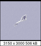
Is the 1587.png file correct?
It's about the bottom part of the picture
Re: MAPS: Post information about new maps here please
It's an error. I'll always upload original files to discord. There i can easily upload the rar files without hosting.
Slava Ukraini!