Mapy
Moderator: Jaro
Mapy
Thanks for writing here
He knows all these 'tricks' - probably only Waldzios
Recently (about 1.5 months ago) I designated an area for a new map / maps
However, the work does not go forward ..
And in terms of maps - my style only causes trouble
After taking the map - the files have a very large weight in megabytes, so it reduces colors to fit in the limit
This impairs quality
I wanted to send - only jpg files (generated before color reduction - like for 5xxxx maps), but MapFinder has established procedures and you need a file in png format.
Re: Spotkanie z OG po polsku
Which graphics editor do you use? When saving a png i always choose "save for internet" in photoshop. Then i use 8 bit png with 256 colors or less colors (depends on map).sympatyk wrote: ↑2020-03-07 16:40, Saturday And in terms of maps - my style only causes trouble
After taking the map - the files have a very large weight in megabytes, so it reduces colors to fit in the limit
This impairs quality
I wanted to send - only jpg files (generated before color reduction - like for 5xxxx maps), but MapFinder has established procedures and you need a file in png format.
Re: Spotkanie z OG po polsku
I use Gimp ... and I do it similarly ...
It's about jpg
- You can get it directly from 24bit
- and after reducing the color of the png (8bit) file
If you compare these files carefully, you'll see a difference in quality
It all depends on how many separate colors (shades) were in the original file ..
It can be seen in my ocean (waves), on winter maps, where the tonal distance is very close ...
Re: Spotkanie z OG po polsku
The file size of a map also depends on the used colors. I only learned that light blue (ocean) has low bit costs and ocean maps or islands have (often) a small file size when compared to land maps. But you can do nothing about it
What is your initial problem? I mean, do you get maps with 10 megabyte or something like that?
Re: Spotkanie z OG po polsku
Land maps - from the 3000 series - are 25 MB, maps from the 50,000 series - 60-70 MB
The maps have an average of 550,000 to 850,000 separate colors
It all depends on the texture .. and the scale of the gradient
The maps have an average of 550,000 to 850,000 separate colors
It all depends on the texture .. and the scale of the gradient
Re: Spotkanie z OG po polsku
Sorry, i think we got stuck in the language barrier
The photoshop files i used can be up to 120mb for one map, but that does not determine the file size of the jpg and png maps.
If you have problems with your style, have you ever tried to use the traditional maps as templates?
The photoshop files i used can be up to 120mb for one map, but that does not determine the file size of the jpg and png maps.
If you have problems with your style, have you ever tried to use the traditional maps as templates?
Re: Spotkanie z OG po polsku
To show the problem better
In the first and second screenshot you can see a piece of the map
Image first - 14.36 MB, 695,003 colors
Then - 3.06 MB, 256 colors
See and compare the waters - ocean, lakes - are they equal?
Gimp files with complicated maps exceed 1GB, but can reach over 2GB - then you have to be patient - because the processing takes a long time ...
As I say, I have 40 from the basic layers, and there have been over 500 of them ...
Why doesn't he copy - from maps - other people?
... There was a discussion about copyright but it died ...
... okay
Re: Spotkanie z OG po polsku
1 or 2 GB for one map. That is a lot. All my 111 photoshop map files have less than 6GB together.Gimp files with complicated maps exceed 1GB, but can reach over 2GB
Working on a file with more than 100mb can be critical on my old laptop. I try to keep the file size small and also try to limit the number of layers.
I guess that happens to everybody more or less. To me too.sympatyk wrote: See and compare the waters - ocean, lakes - are they equal?
When i made the map the color gradient was smooth, now it looks like terraces. But when playing, i think nobody cares anymore. It is okay
Re: Mapy
Hello Clemens
A small explanation first
What I wrote about the map discussion concerns only me and a certain event
My colleague had a daughter who was studying
Students posted lecture notes, book scans, etc. online
One day the police came and did a search - because the copyright of one of the books had been violated
And there was a discussion about respecting copyright
The girl had this book bought - so it ended in fear ... (the matter died a natural death)
I started doing maps at that time ... and got a little scared
I didn't want to copy ..
....................
Your drawing is highly enlarged - then everything becomes blurred (toothed)
I was talking about differences in colors
Re: Mapy
Me too. The terraces appear because the colors are changed. In the original file there is a smooth color gradient becaue millions of colors are available.sympatyk wrote: Your drawing is highly enlarged - then everything becomes blurred (toothed)
I was talking about differences in colors
In the png file the colors are cut to 256 and the terraces appear. Because the colors got changed.
Re: Mapy
Ah this language
If you make from the original file -> directly a jpg file (before color reduction) - you will get a better quality file
Road -> original file - png file - color reduction - png file - jpg file -> gives a poorer file (with comparable file weight in MB)
If you make from the original file -> directly a jpg file (before color reduction) - you will get a better quality file
Road -> original file - png file - color reduction - png file - jpg file -> gives a poorer file (with comparable file weight in MB)
Re: Mapy
I just wanted to write - jpg map (last picture) - it may be better quality than the png file you send to Luis
However, MapFinder has its own procedures and needs a png file -> conversion of this png file (after color reduction) -> to jpg - gives a lower quality file (jpg - it is on the server and is downloaded automatically and is used for the game)
But you're right - we're ending this discussion
However, MapFinder has its own procedures and needs a png file -> conversion of this png file (after color reduction) -> to jpg - gives a lower quality file (jpg - it is on the server and is downloaded automatically and is used for the game)
But you're right - we're ending this discussion
- LuisGuzman
- General, Special Forces
- Posts: 673
- Joined: 2019-03-10 08:35, Sunday
- Location: Spain
- Contact:
Re: Mapy
So, if I've understood properly, you say that converting from png 24 bpp (as it is in the graph editor) to jpg makes a smaller jpg file (1,69 MB with 24 bpp) than converting from a png after reducing it to 8 bpp to jpg (3,06 MB), right ?
But is it true regardless you use any graph editor (Gimp, Photoshop, paint.net of whichever) or using an external tool like IrfanView or similar ?
I have to test that myself ... because if this is true regardless the map type, I should modify the way to upload maps to Mapfinder ... because any reduction in size is important.
Visit my website to get my latest tools.
Re: Mapy
I found out and wrote at JP's one ore two years ago that the jpg i send you get actually bigger [!] when you load them to mapfinder. Because the conversation process is apllied to the jpg too. So it is small jpg -> bigger jpg.LuisGuzman wrote: ... because any reduction in size is important.
Is someone working on png files when working on maps? I mean, in photoshop i use psd files and then "save for web" to create the png and jpg i submit. I don't know if there is something like gimp files?
The jpg i submit i save with 40% - 50% quality to save file size. Often 40% is enough.
- LuisGuzman
- General, Special Forces
- Posts: 673
- Joined: 2019-03-10 08:35, Sunday
- Location: Spain
- Contact:
Re: Mapy
I surely missed that, sorry
Ah ... the reason is because the script, used to upload to MapFinder, converts the .png to .jpg using 70%The jpg i submit i save with 40% - 50% quality to save file size. Often 40% is enough.
Well, I've done a few test as these are my conclusions:
- the .png file can be omitted when uploading to MapFinder (then, only the .jpg file can be downloaded)
- I can tweak the script, used to convert and upload the 4 .jpg files that MapFinder require, in order to upload the .jpg eventually received from the mapmaker.
The other 3 jpg used (100,200 and 500 pixels max) can be still converted from the .png. - Not always the .jpg (24bpp) sent by the mapmaker is smaller then the one converted from the .png 8bpp
- For automatic download, I upload the .jpg file received from mapmaker if available, otherwise I convert the .png file using IrfanView with a 70% compression ratio.
I remember that some time ago Kowdar offered to host the maps as .png in his server, so maybe he could provide a procedure to allow downloading .png files by mapmakers wanting to use any to create a new one.
Visit my website to get my latest tools.
Re: Mapy
As I wrote - I am in favor of deleting my * .png files + simultaneous - replacing * .jpg files -> to 24bit jpg files (I will prepare them myself)
This should be done slowly and in batches
I've always wondered - why do we collect png files - of lower quality and more MB weight?
Now what is important
Bmp / png files - they were needed to create shp files -> this is related to the indexed color palette
Some of my maps were made into S16 (People’s General) files -> they must stay as they are
All maps made during PG2 -> must remain
All maps made - not in indexed color - can be replaced (delete the png file)
It doesn't make sense - store (share) maps png in reduced color (they are much inferior in quality and weigh more MB)
Every creator should comment
Clemens
I'm using Gimp - it's too free
All files for this game (maps, portraits, flags, etc.) go through GIMP -> IrfanView (it has many advantages)
Luis
If we enable subsampling - we'll get - even lower weight of the file
Re: Mapy
For me, PNG has the higher quality. Yes, less colors. But higher quality!
JPG often have some kind of artefacts or blurred pixels. Thats why map makers use the PNG files as templates, no?
Because there is always a quality loss with JPG. Of course, i can save JPG file at 100% and get 7-10mb for a standart map
I'd rather see my JPG removed than my PNG maps to save web space. Problem then is with automatic download of bigger files
Personally i'd keep things like they are now.
Re: Mapy
I searched archival records of my work
I made Jpg files - from all maps (apart from maps made for Michael - PEG)
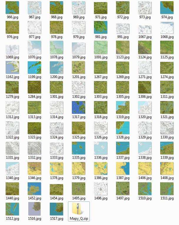
There are 83 maps in total - I have placed in the zip directory -> Mapy_Q.zip
https://drive.google.com/file/d/1myqMwm ... sp=sharing
So you can start the replacement operation on MapFinder -> delete all existing images in png and jpg format -> replace them only with images in Jpg format from the Mapy_Q.zip catalog
MapFinder will gain a lot of free space (estimated to be over 250MB)
The maps will be similar to the original files (color + quality)
Kowdar maintains the ability to host png files (in my opinion - this is unnecessary ballast )
Maps from the Mapy_Q package - should also be found on servers for automatic map downloading - instead of previous files
In the form of a picture I present - which maps are concerned
Re: Mapy
Sorry ... there was a map of an earlier version in the zip (I corrected it in 2019 - a piece of the brown road)
Correct map
http://www.opengeneral.pl/sympatyk/979.jpg
I also corrected it in a zip ...
.................................................. ..
I once made such compilations -> is it worth publishing?
map 15 + 16 as a whole
http://www.opengeneral.pl/sympatyk/1516S.jpg
http://www.opengeneral.pl/sympatyk/1516S.mapx
Map 45 + 49 + additional sea
http://www.opengeneral.pl/sympatyk/4549_3000.jpg
http://www.opengeneral.pl/sympatyk/4549_3000.mapx
Re: Mapy
Please notice that sometime ago i draw new map (954) for Sidi Rezeigh area
just to correct cities and airfields.
It was used for "Crusader" scenario, in my "Znak Orła" campaign. As i remember
this map is basically build on 215 picture, only with details mentioned above.
just to correct cities and airfields.
It was used for "Crusader" scenario, in my "Znak Orła" campaign. As i remember
this map is basically build on 215 picture, only with details mentioned above.
Re: Mapy
Btw, Gustlik, you still have one map number booked, 965. Do you still need it? If not, I would take it over, so we can close the gap in the list.
In the next 2 - 3 months i am going to make a dozen maps
Re: Mapy
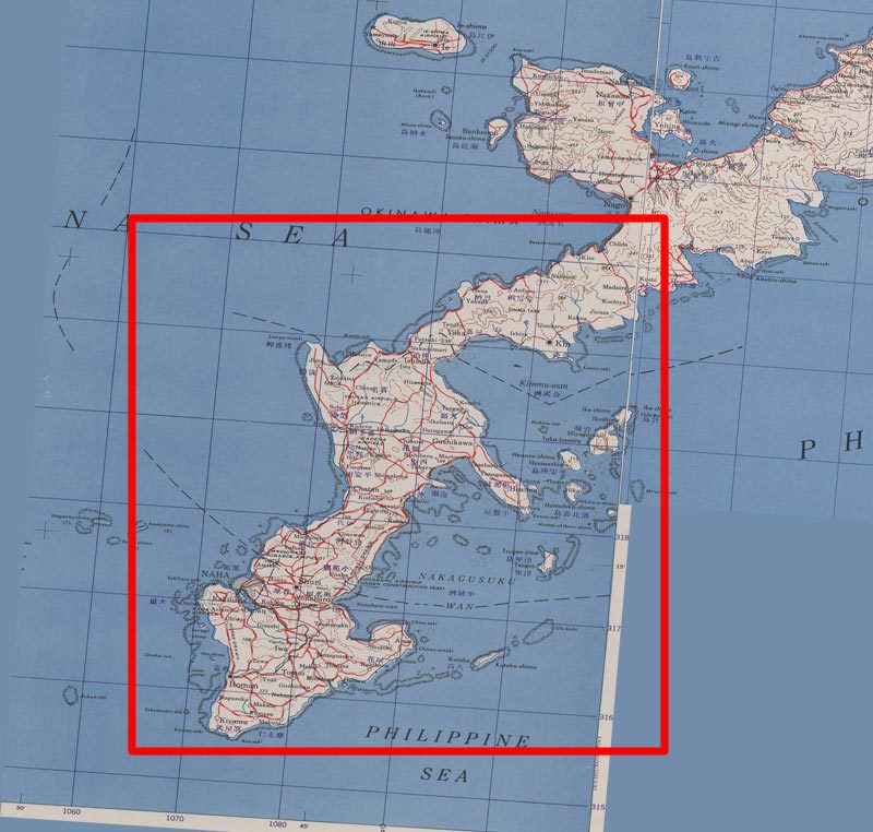
Sorry, maybe i misunderstand, but do you need a bigger map with more water in the south? So ships can sail around the island in the south.Gustlik wrote: Oczywiście i jak najbardziej. Nigdy nie wiadomo kiedy komy i jakiej mapy zabraknie.
Ja mam na przykład taki zgryz z mapą 999 "Naha". Jest w kampanii "Greater America" - fajnie tylko
autorowi zabrakło jednego heksa, żeby dało się przepłynąć dookoła.
No i co, okręty mają po lądzie pływać?
I already made some research about Okinawa in the past and have the file stored. I could enlarge the map easily in few days if you are interested.
Re: Mapy
As for the 999 map, Santiago reserves the copyright -> you cannot modify / change its maps
Are you going to create a new map from scratch?
So do it - of course the map should match the air / sea / land battle -> yes you need the ocean in the south
If you read our forum - there is a discussion about sea mines, minesweepers .. their parameters
Oh, I enlarged the collage of 15_16 ..
Now it is 3 maps in one -> 15_16_954 + more sea
http://www.opengeneral.pl/sympatyk/15_16_954.jpg
http://www.opengeneral.pl/sympatyk/15_16_954.mapx
.......................................................................
I have also opened (for a long time) a large project for 3 maps of Germany ..
Somehow I still can't put all these buildings ... I don't know if I can make it before Easter
I'm sorry that I am entering your area ...
Re: Mapy
People modified maps all the time for many many years. If you look at all the maps at mapfinder you will identify grafics taken from many other maps.
I understand if you don't want to do it and use your own style, but there are more than 100 map makers who all used the same grafics copied from all the maps.
Then, who knows which map maker invented this or that grafics in the recent 20 years
Then you also should not do the desert map because the original grafics are not yours, no?
I guess everyone who uploads maps to mapfinder agrees that other people can use it as templates. Hasn't it ever been like this?
We already had this discussion at JP's and it leads to nothing
Re: Mapy
Misunderstanding
I'm just talking about Santiago
No one else did itOn the Santiago Fuertes website (old page - last entry 2011)
http://latingenerals.gilestiel.eu/
I discovered, to my surprise, that there is a license ...
BY-NC-ND
Creative Commons license
And you write well - people have always copied ...
And you are right - these recently shown - maps by me - have the original SSI
I like your maps - they are nice
I don't want to change anything ...
Re: Mapy
Oh wow, i didn't know there is/was a license.sympatyk wrote: ↑2020-03-23 21:51, Monday
Misunderstanding
I'm just talking about Santiago
No one else did itOn the Santiago Fuertes website (old page - last entry 2011)
http://latingenerals.gilestiel.eu/
I discovered, to my surprise, that there is a license ...
BY-NC-ND
Creative Commons license
And you write well - people have always copied ...
And you are right - these recently shown - maps by me - have the original SSI
I like your maps - they are nice
I don't want to change anything ...
But he has to attach the license to every single map picture. The best would have been to write it onto every map picture. The link is dead. No license is shown at mapfinder. So i think it is invalid But i am no lawyer
But, and that is a big BUT, he also used SSI grafics! Just check some houses... No map maker can license SSI grafics in own creations
Yes, he signs his maps, but some other map makers sign their maps too, and use grafics of others. I know it very well because i am lookign at these maps every day
We will never get trough this legal jungle
Re: Mapy
Here is a text how to apply a license to your offline work. A map picture is offline work (EDIT: I think, but i am no lawyer ), because you can dowload it and use it without internet connection.
The creative commons website clearly says, that the work should be marked. Every single piece of work has to be marked. Everey map picture.
How do I apply a Creative Commons license to my material?
For offline material: Identify which license you wish to apply to your work and either (a) mark your work with a statement such as, “This work is licensed under the Creative Commons [insert description] License. To view a copy of the license, visit [insert url]”; or (b) insert the applicable license buttons with the same statement and URL link.
Re: Mapy
My friend
I don't know if Google - it translates well ..
Let's skip legal complexities ...
I was interested in the issue of copyright ...
I asked old users - Luis, Gustlik, Micha ..
I can't convey it all in English ...
but let us stick to what has been developed by the community
What is not prohibited (in this community - is allowed)
-------------------------------------------------------------------------
Because Santiago clearly stated the license - I respect that.
SSI maps - attempts were made here - to obtain a license - no official response - neither yes nor no.
PEG - one of the developers of the game -> allowed - to use this game freely -> but there is no official document.
There is also common sense and decency - if you say - don't move my work -> I will do it -> if you do not reserve anything - by default I can use your work for further processing (because that's the rule here)
I know another man who reserved his entire e-file ... and he doesn't exist here. But this is a different story ..
---------------------------------------------------------------------------
... I made several such maps (earlier) - to check the difficulty ...
Now I thought - maybe someone needs it?
(Gustlik campaigns for the Cold War -> a different look at maps needed -> larger maps needed for combined naval / air / land battles ...)
regards
Re: Mapy
The link you posted is broken -> No license
I could not find a latingenerals website -> No License
When i play the game is see no license for his maps -> No license
When the game downloads maps i see no license for his maps -> No license
When i look at mapfinder -> No license
When i look at his map pictures -> No license
We can not ask him because he is gone. I never read something from him, so it must be a looong time ago -> No License
He uses SSI grafics in his maps, he can not license other peoples grafics - No license
So were can i find the license for a certain map picture? There is no valid license for his maps and if you wouldn't write it again and again nobody would care
But okay, i will not modify the Okinawa map... I just asked if i could help. Sorry for that.
Re: Mapy
Yes, it was a long time ago - PG2
The license was - I read it myself
You have nothing to apologize for
You can do this map again - your method ... as you like
Santiago maps are a bit different than SSI
In those days - some people wanted to earn money on PG2 ...
- mythos
- Second Lieutenant
- Posts: 784
- Joined: 2019-09-30 19:37, Monday
- Location: near a faerie forest in a misty vale
Re: Mapy
sympatyk wrote: ↑2020-03-09 15:37, Monday
As I wrote - I am in favor of deleting my * .png files + simultaneous - replacing * .jpg files -> to 24bit jpg files (I will prepare them myself)
This should be done slowly and in batches
I've always wondered - why do we collect png files - of lower quality and more MB weight?
Now what is important
Bmp / png files - they were needed to create shp files -> this is related to the indexed color palette
Some of my maps were made into S16 (People’s General) files -> they must stay as they are
All maps made during PG2 -> must remain
All maps made - not in indexed color - can be replaced (delete the png file)
It doesn't make sense - store (share) maps png in reduced color (they are much inferior in quality and weigh more MB)
Every creator should comment
Clemens
I'm using Gimp - it's too free
All files for this game (maps, portraits, flags, etc.) go through GIMP -> IrfanView (it has many advantages)
Luis
If we enable subsampling - we'll get - even lower weight of the file
http://www.opengeneral.pl/upload/n4.jpg
Nie rozumnie: twojy mapy sa bardzo super !
Dlaczego chcesz je zabrać ?
Re: Mapy
Alternative maps drawings
These are maps drawings made mainly for PEG
Dimension not exceeding 1920px, in bmp / png format
directory / folder
....................
Alternatywne rysunki map
Są to rysunki map wykonane głównie dla PEG
Rozmiar nieprzekraczający 1920px, w formacie bmp / png
katalog/folder
https://drive.google.com/drive/folders/ ... sp=sharing
oraz/and
http://www.opengeneral.pl/sympatyk/10-churubusco.png
http://www.opengeneral.pl/sympatyk/11-molino del rey.png
http://www.opengeneral.pl/sympatyk/12-chapultebeck.png
http://www.opengeneral.pl/sympatyk/1resdelapalma.png
http://www.opengeneral.pl/sympatyk/1viet.png
http://www.opengeneral.pl/sympatyk/2paloalto.png
http://www.opengeneral.pl/sympatyk/2vietnam_nov.png
http://www.opengeneral.pl/sympatyk/3montrerrey.png
http://www.opengeneral.pl/sympatyk/3vietnam1.png
http://www.opengeneral.pl/sympatyk/3vietnam_nov.png
http://www.opengeneral.pl/sympatyk/4brazito.png
http://www.opengeneral.pl/sympatyk/4dai-2.png
http://www.opengeneral.pl/sympatyk/4dai-nov.png
http://www.opengeneral.pl/sympatyk/5apchinan1.png
http://www.opengeneral.pl/sympatyk/5buennovista.png
http://www.opengeneral.pl/sympatyk/6-saltillo.png
http://www.opengeneral.pl/sympatyk/7chaunhay.png
http://www.opengeneral.pl/sympatyk/8-cerro gordo.png
http://www.opengeneral.pl/sympatyk/8-conthien.png
http://www.opengeneral.pl/sympatyk/9-contreras.png
http://www.opengeneral.pl/sympatyk/mapa1rr.png
http://www.opengeneral.pl/sympatyk/mapa2_l2.png
http://www.opengeneral.pl/sympatyk/mapa333r.png
Additionally
maps stylized for the PG2 palette
Dodatkowo
mapy stylizowane na paletę PG2
https://drive.google.com/drive/folders/ ... sp=sharing
Re: Mapy
Hello sympatyksympatyk wrote: ↑2020-03-15 15:55, Sunday I once made such compilations -> is it worth publishing?
map 15 + 16 as a whole
http://www.opengeneral.pl/sympatyk/1516S.jpg
http://www.opengeneral.pl/sympatyk/1516S.mapx
Map 45 + 49 + additional sea
http://www.opengeneral.pl/sympatyk/4549_3000.jpg
http://www.opengeneral.pl/sympatyk/4549_3000.mapx
Will you publish these two maps?
I would like to use them
(Maybe the dimension (3150 × 2819 Pixel) and (2144 × 1660) can be streamlined a little bit?)
Re: Mapy
Maybe you want to use a larger map?
http://www.opengeneral.pl/sympatyk/15_16_954.jpg
http://www.opengeneral.pl/sympatyk/15_16_954a.mapx
What would you like to modify or change?
(Applies to all maps)
http://www.opengeneral.pl/sympatyk/15_16_954.jpg
http://www.opengeneral.pl/sympatyk/15_16_954a.mapx
What would you like to modify or change?
(Applies to all maps)
Re: Mapy
These two are good, i'd like to use them
Maybe you can adjust the size and make them 3150 x 3000 and add a little desert or ocean?
I like it more when the dimensions are "right". Maybe that is just how my brain works
Re: Mapy
The drawings seem to be ready ...
Suit you?
At mapx, you have to wait ...
http://www.opengeneral.pl/sympatyk/15_16_954bis.jpg
http://www.opengeneral.pl/sympatyk/4549_3000bis.jpg
Re: Mapy
Perfect Thanks a lotsympatyk wrote: ↑2020-07-04 11:42, Saturday
The drawings seem to be ready ...
Suit you?
At mapx, you have to wait ...
http://www.opengeneral.pl/sympatyk/15_16_954bis.jpg
http://www.opengeneral.pl/sympatyk/4549_3000bis.jpg
Re: Mapy
It seems that the mapx are ready
http://www.opengeneral.pl/sympatyk/15_16bis.mapx
http://www.opengeneral.pl/sympatyk/45_49bis.mapx
There is no merit here -> I just combined the maps - 15, 16, 954 and 45, 49
What should they be called?